Appeal for Indiana Avenue Tree Removals
I would like to appeal the tree removal request of 1459 Indiana Avenue on the following grounds.
No Reasonable Risk of Injury or Harm
Public Works presented (emphasis mine):
On January 22, 2025, the City Arborist inspected the trees and approved the removal of both. The approved tree removal permit application (Attachment 3) was based on the lean of the trees, the poor soil conditions, and the possibility that the trees could uproot due to soil instability. Staff recommends approval of the removal permit, as it meets the criteria outlined in SPMC Section 34.11(a)(1), which states that a tree may be removed if it poses a reasonable risk of harm to persons or property or substantially interferes with the structural integrity or use of existing structures, and if there is no feasible alternative to mitigate the issue.
34.11(a)(1) of our municipal code reads:
Where the tree poses a reasonable risk of injury or harm to persons or property or is substantially interfering with the structural integrity or the use of an existing structure (including, but not limited to, a fence or wall), swimming pool, or building and there is no feasible and reasonable alternative to mitigate the interference.
Cedar
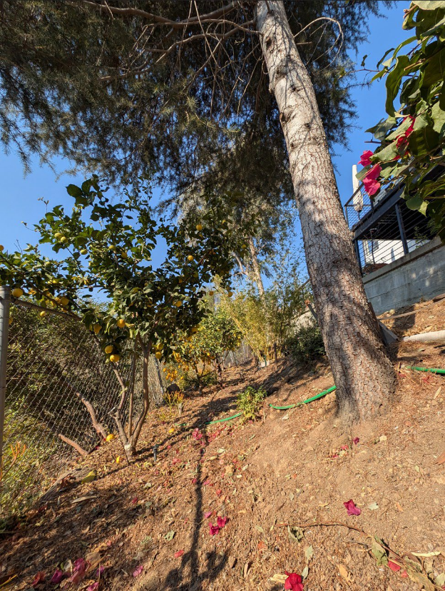
The cedar's lean corrects itself 5 feet from the base and is otherwise perfectly straight and symmetrical from that point on with a single healthy leader. It is a young tree and this ever so slight lean will fade with time as the trunk grows.
The root flare has already adapted to the slope and is appropriately situated at the current grade. There doesn't appear to be any soil slippage in the given photo.
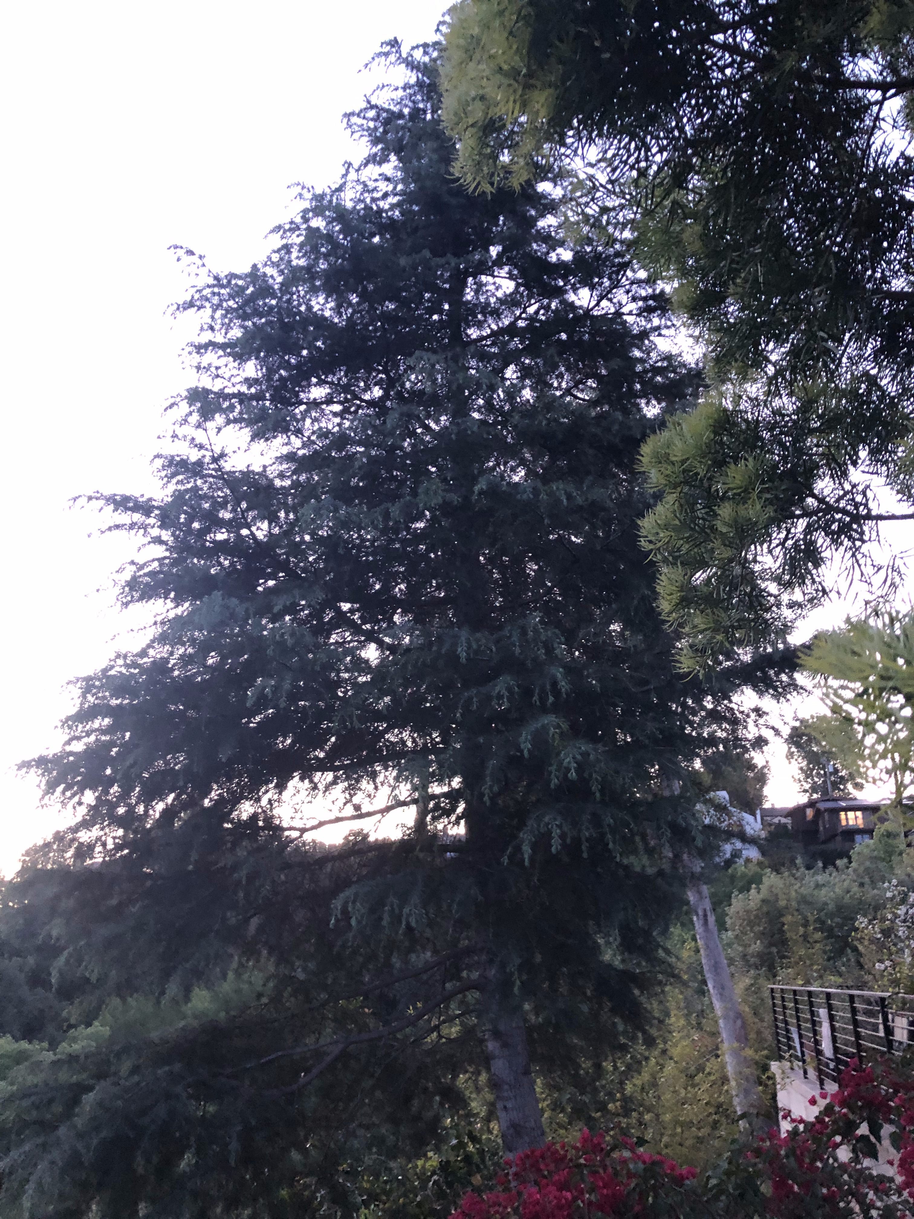
Gum
The gum's lean was present five years ago as seen in drone imagery.
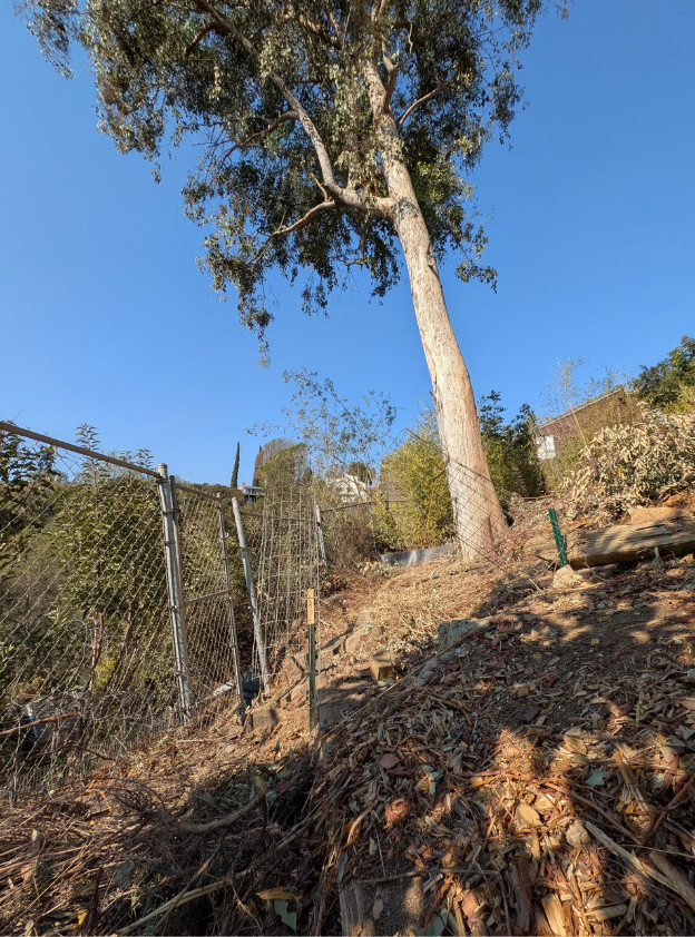
The root flare is completely buried. It is impossible to understand the state of the root system without excavating to the slope's original grade.
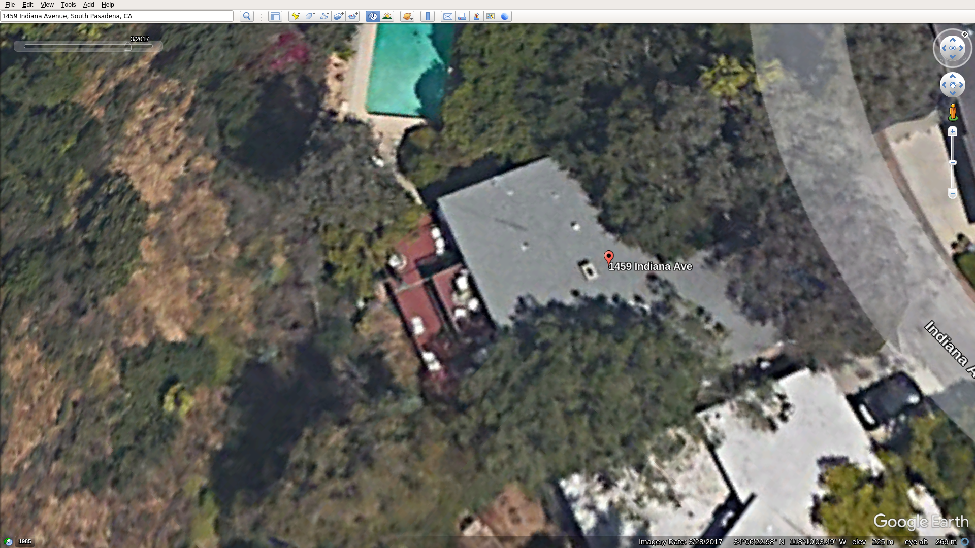
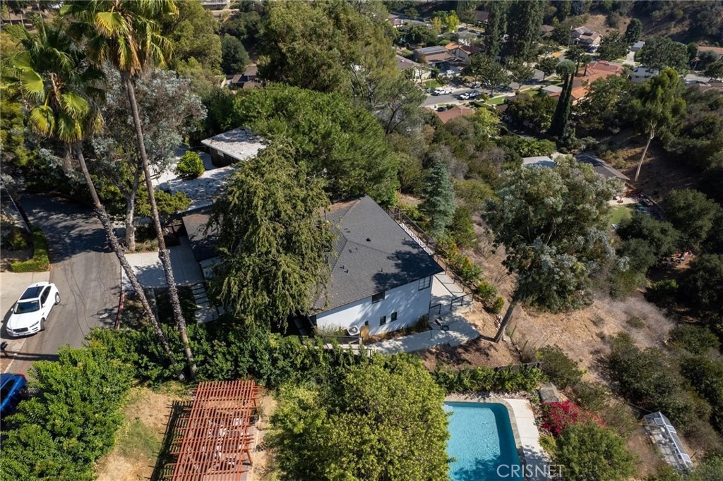
Soil Slippage/Instability
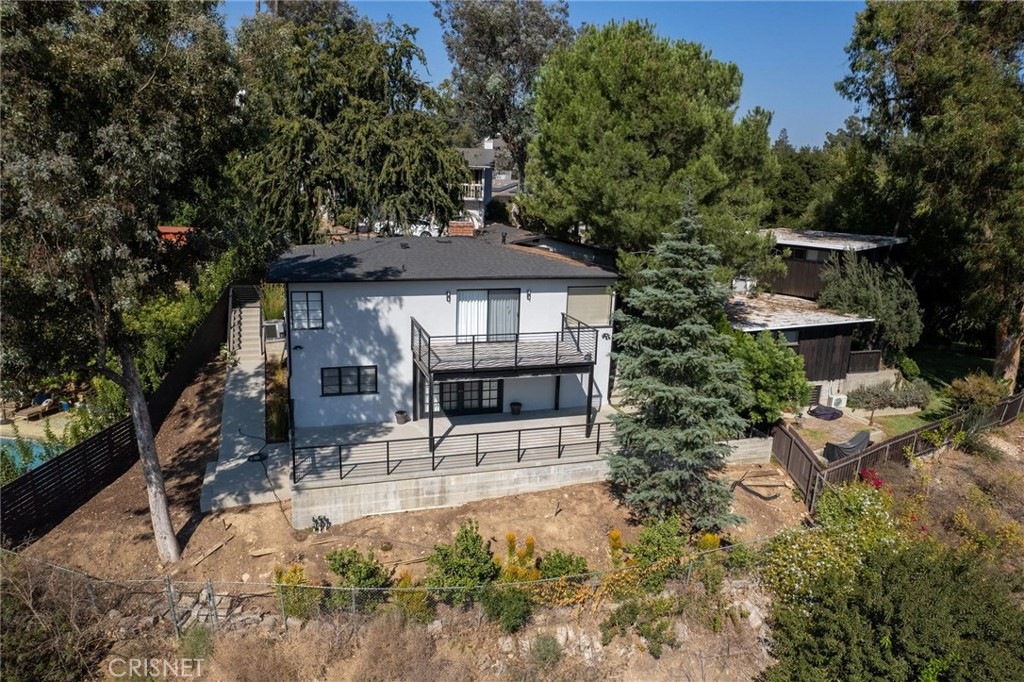
The soil slippage and instability issues are a result of a previous unpermitted tree removal (light green overhanging corner of deck), unpermitted grading and overzealous concrete construction.
Removing the last two trees stabilizing the hillside would introduce more instability to a site only recently made unstable by concrete work that is set to remain and continue to contribute to site instability.Site History
2017/2018 – Redwood Deck
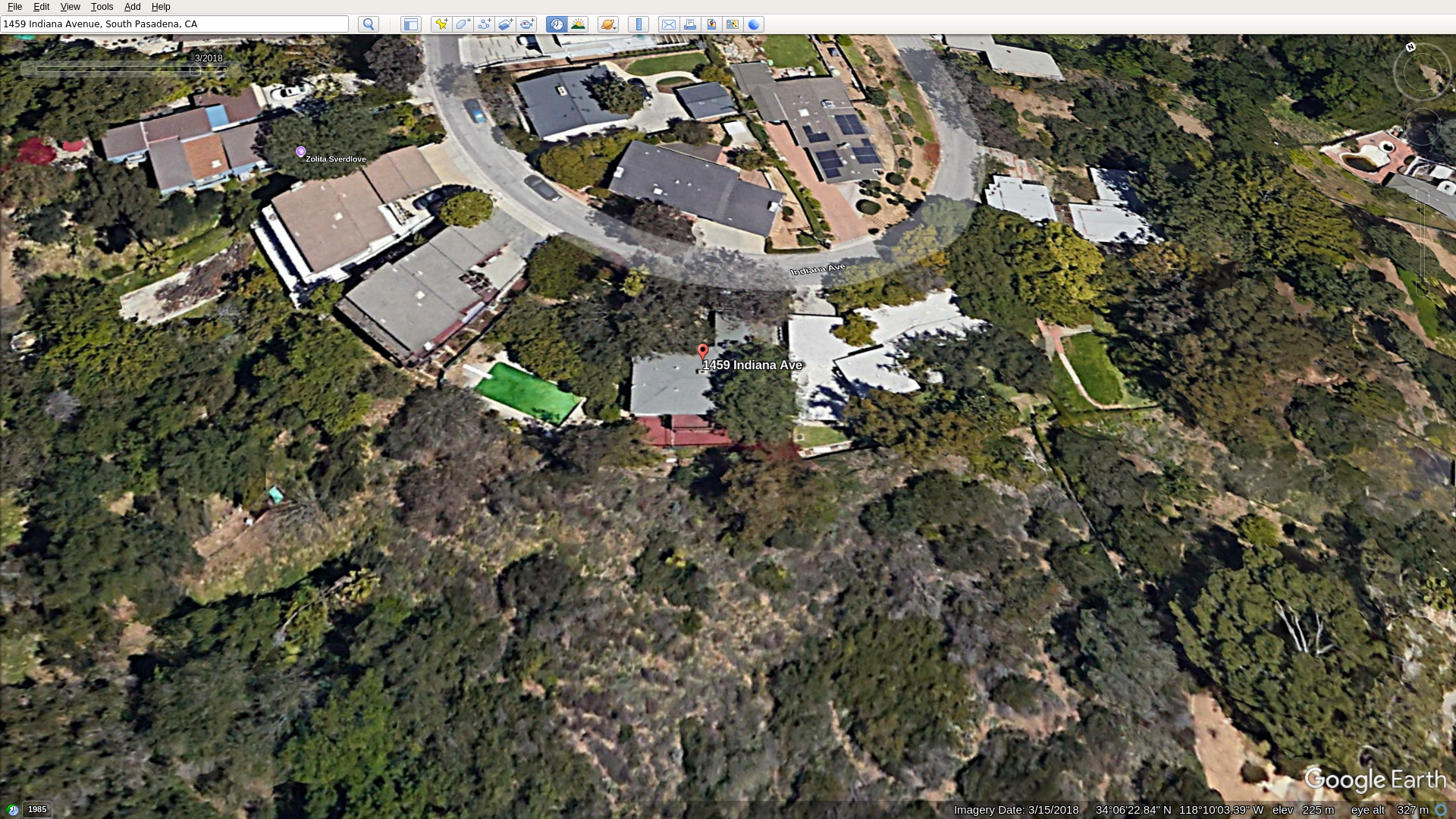
Notice:
decking and flatwork from deck to pool
presence of downslope fence
light green tree overhanging corner of deck
tree casting shade on backyard slope
the overall vegetative state
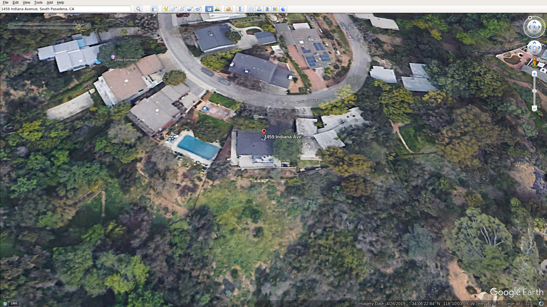
2019 – Concrete Deck
The son of a local business owner remodeled the home. He went against the city's wishes of subdivision and subdivided at the county level to sell half the parcel to the neighbor. He had at least one tree removed and the wood deck replaced with a concrete deck.
2021
The current owners purchased the property in 2021.
2025 – NREC Meeting
One of the owners made several statements about the slope behind his home.
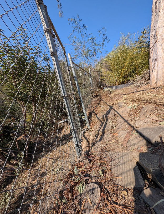
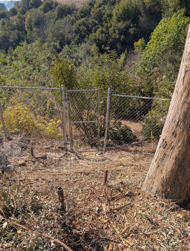
And you can see in the picture there is a chain link fence. ... When we first moved in the latch of the fence actually latched, just barely. In the picture now you see it's 4-6" apart. Over time, even with the trees, the ground keeps slipping.
Owner, 46:54
We've planted lavender and lantanas and sort of things to try to keep the soil in place but it holds the superficial soil in place but the hill keeps sliding.
Owner, 49:54
Site Conditions
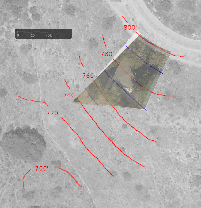
This photo is a layering of a 1940s aerial photograph and three maps from the LA County Assessor's data–topographical, 2014 satellite and 2020 satellite
Zillow states square footage is 7,204.
The average slope as defined in 36.340.020(C) is:
(100 * (10 * 310)) / 7204 = 43%
SPMC Chapter 34 – Trees and Shrubs
34.9 Tree Removal Permit Applications
(a) Any person applying for a tree removal permit shall file with the director an application in writing on a form furnished by the director. The application shall contain the following information:
(4) A tree removal and replacement plan in accordance with this chapter;
(b) In addition to the application requirements of subsection (a) of this section, tree removal applications associated with development shall include all of the following:
(1) An arborist report prepared by a certified arborist;
(2) Project narrative;
(3) The proposed development plan depicting the actual and proposed location of structures, topography and existing trees, whether to be retained or proposed for removal;
(4) Site plan with elevations showing before and after sight lines of the properties landscaping and trees;
34.12 Tree Removal and Replacement Plans
Tree removal and replacement plans shall contain the following information:
(a) A drawing of the property which shows the location and species of all existing protected trees;
(b) A site plan showing the proposed development, including all existing and proposed structures, including the topography of the site, in accordance with SPMC 34.9(b);
(e) A second drawing of the property after the proposed tree removal which shows remaining trees and all proposed replacement trees. The replacement tree sizes and species must be clearly identified; and
(f) A certified arborist review of the tree plan, if required by the director. The certified arborist shall be contracted and managed by the city and all fees incurred shall be the responsibility of the property owner. (Ord. No. 2328, § 1 (part), 2019.)
Tree Replacement Plan and Application Insufficiencies
The applicant's replacement plan does not account for restitution trees for previous unpermitted removals.
The provided tree replacement plan is missing:
34.12(a) – location and species of all existing protected trees
34.12(b) – site plan showing proposed development, existing and proposed structures, topography of the site
34.12(e) – second drawing after tree removal which shows remaining trees and all proposed replacement trees with sizes and species clearly identified
Public Works has stated that the additional criteria is not needed due to this not being development related. The code does ask for a full replacement plan for non-development track removals. These trees are directly impacted by unpermitted building in the immediate vicinity and any such permits should have in the past and should, moving forward, trigger the development track protections and additional replacement plan requirements.
Additional requirements for development related applications that should have been met alongside permitted grading and retaining walls:
34.9(b)(1) – arborist report
34.9(b)(2) – project narrative
34.9(b)(3) – proposed development plan depicting the actual and proposed location of structures, topography and existing trees, whether to be retained or proposed for removal
34.9(b)(4) – site plan with elevations showing before and after sight lines of the properties landscaping and trees
SPMC Division 36.340 – Hillside Protection
36.340.010 Purpose of Division
The standards of this Division are intended to:
A. Preserve the City’s scenic resources by encouraging retention of natural topographic features and vegetation;
B. Acknowledge that as the slope of a development site increases so does the potential for environmental degradation including slope failure, increased erosion, sedimentation and stormwater run-off; and
C. Encourage grading practices that are appropriate in hillside areas; and
D. Encourage structures on hillside parcels to be designed with scale, massing, architectural design and detailing appropriate to maintain hillsides in a natural, open character.
36.340.020 Applicability
A. Sloping sites. The standards in this Division apply to subdivisions, uses, structures, and to all other development on sites with an average of slope of 20 percent or greater.
36.340.030 Permit and Application Requirements
Development that is subject to this division shall require a Hillside Development Permit (SPMC 36.410.065) and Design Review (SPMC 36.410.040). The application shall include:
B. Geotechnical report. A preliminary geotechnical report that identifies and proposes mitigation measures for any soils or geological problems that may affect site stability or structural integrity. Depending upon the site characteristics and project design, a final geotechnical report may also be required as part of a subsequent Building Permit application.
36.340.040 Hillside Development Design Guidelines
Proposed hillside development should satisfy as many of the following objectives as feasible, as determined through the Design Review process.
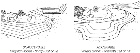
A. Terrain alteration. The project should be designed to fit the terrain rather than altering the terrain to fit the project. Development patterns that form visually protruding horizontal bands or steeply cut slopes for roads or lots shall be avoided. Large-scale slope terracing, cribwalls, or significant slope modification is discouraged. Where alteration of the terrain is necessary, contour grading techniques should be utilized to help achieve a natural appearing slope. (See Section 36.340.050.F and Figure 3-33.)
D. Site layout and structure design. Building and site design should utilize varying setbacks and structure heights, split-level foundations, and low retaining walls to blend structures into the terrain.
36.340.050 Hillside Project Development Standards
F. Natural state. A minimum of 25 percent of the lot area plus the percentage figure of the average slope must be remediated to its natural state in terms of slope and vegetation.
G. Grading. Grading plans shall be prepared in compliance with the Municipal Code and the General Plan. Grading on slopes over 30 percent shall be permitted when sufficient technical information has been provided to support the determination that such development would have no negative impacts on the subject property, adjacent properties, or on the safety and welfare of the public. Grading shall utilize landform grading techniques. See Figure 3-33.
Construction Work
There have been zero permits pulled for any of this work – tree removal or concrete.
The light green tree was removed with the trunk of which appearing to be littered beneath the gum in some half hearted attempt to support the slope.
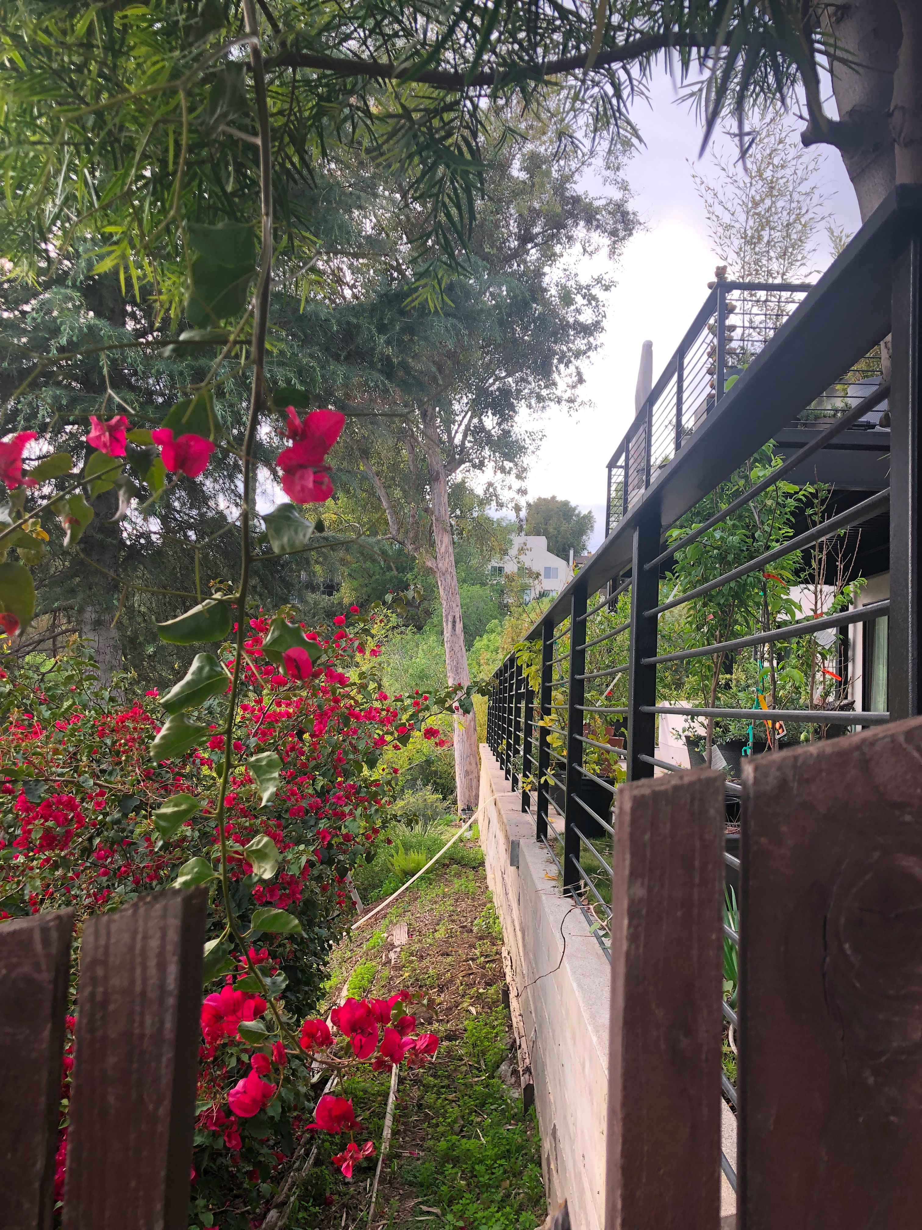
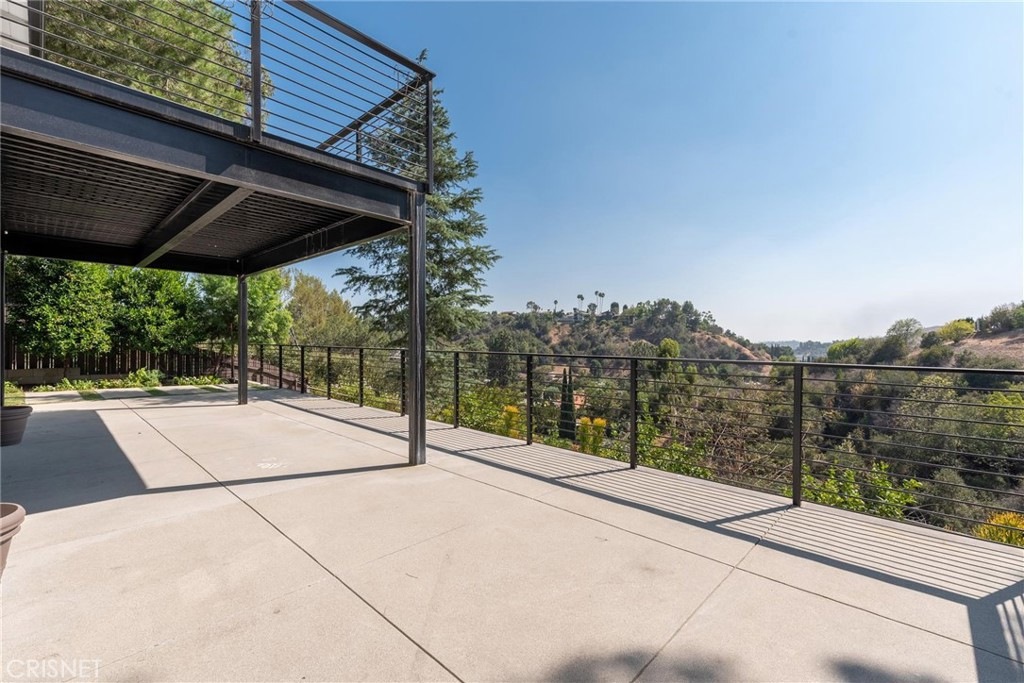
Non-trivial concrete work has wrapped this hillside structure. Concrete is heavy and impervious.
(25% + 43% average slope) == 68% of the lot is required to be in its natural state in terms of slope and vegetation. After the work this threshold is no longer met.
The slab directly above the gum appears to be massive and precariously perched on soft soil.
Below the deck appears to be entirely enclosed contributing greatly to its impervious, unnatural state.
Footing spillout is showing along the length of wall as the downslope part erodes. If the footing was deep enough the soil downslope would be terraced and the slippage mitigated entirely. It is likely the footing is not substantial enough.
The slope of the concrete work appears to be simply draining directly to the footing exacerbating the problem significantly.
Twenty feet of one side of the deck appears to be a planted area and thus is a retaining wall over 3' requiring a permit.
At least one unpermitted staircase was poured with the project.
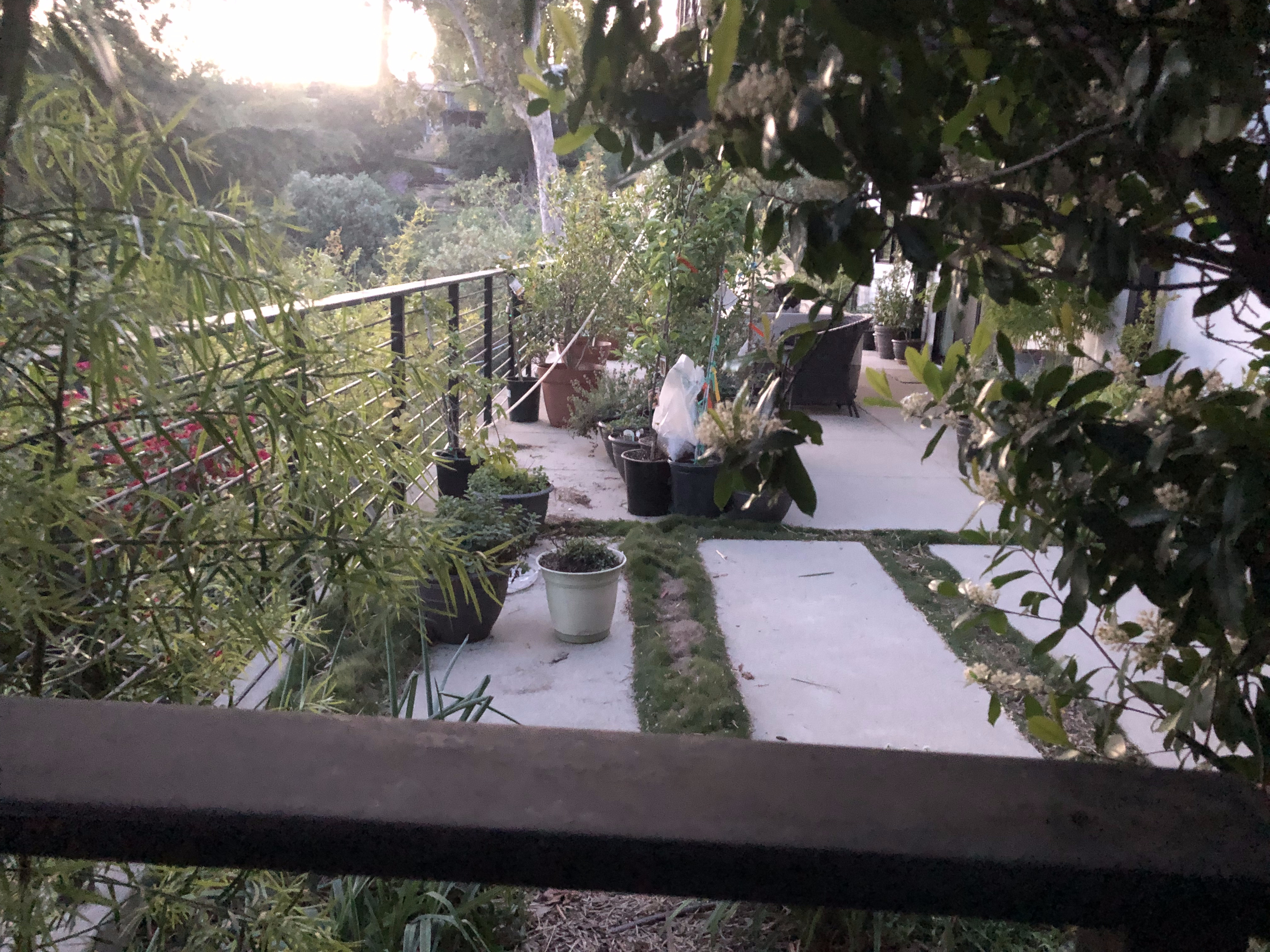
Current Status
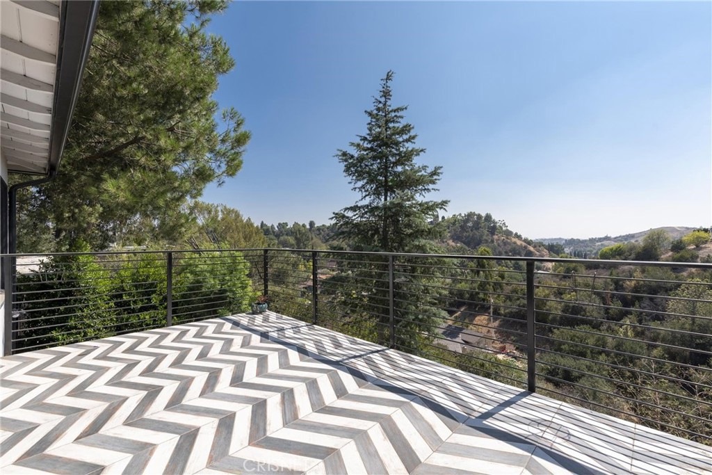
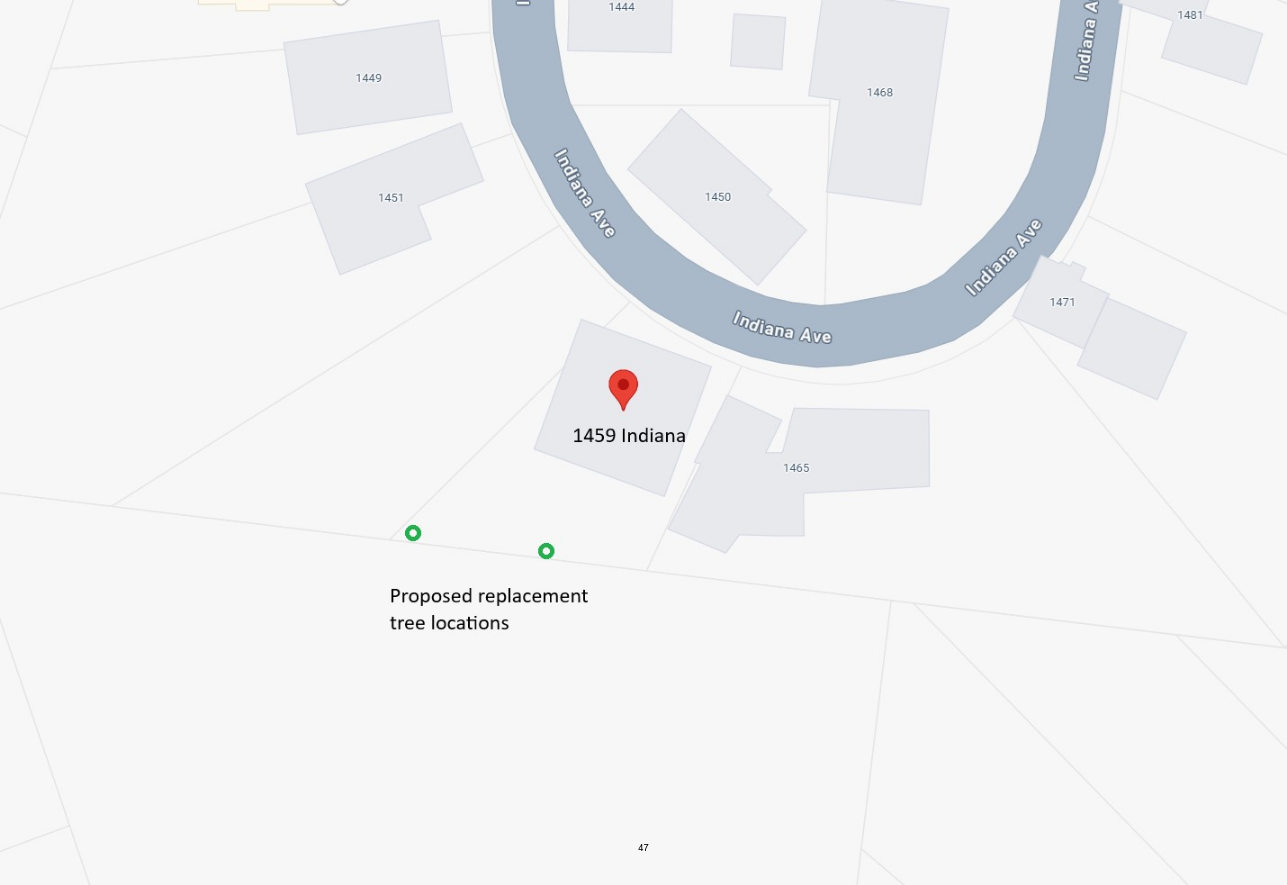
As of now the applicants have stated that they need to talk to someone about installing an admittedly very expensive retaining wall to terrace the hillside so that they can plant the citrus trees shown in the above photo.
I spoke with the applicants on their property two years ago. They said the same thing then and have made no apparent moves in this direction in terms of discovering feasibility or assessing affordability.
The only vegetation that has been planted suitable for hillside retention is bamboo. Bamboo is an invasive that will outcompete trees, natives and citrus. Bamboo is a known fire hazard.
There is no plan. The current owners inherited problems that they are unwilling to solve on their own and the entire neighborhood is paying the price. The NREC was unable to effectively navigate these issues. A past code enforcement request was not taken seriously.
Desired Outcome
Please inspect the site for permit applicability, conformance to design standards and site safety. A soil analysis needs to be conducted. The specs of the wall need to be inspected including face heights, footing sizes and retention loads. The specs of the slabs need to be inspected to determine slope appropriateness.
Permits need to be pulled for work that required permits. This hillside needs to be protected for the owners, present and future, for the immediate neighbors and their structures and all hillside neighbors within view of the slope.
I ask that the directors of Public Works and Community Development intervene and stop the tree removal here as the trees are not the cause of the soil instability but are actually providing a crucial service in keeping the otherwise failing hillside in place.
Furthermore I ask that any permits pulled trigger a full site plan for tree replacement and site remediation.
This request comes with the support of several neighbors inside of the 100' radius of tree removal notification. I will reach out to all neighbors inside of a 250' radius and within direct line of sight of the site for signatures if this proceeds to council as I believe this to be a significant planning related matter that affects more than just the immediate neighbors.
Thank you,
Angelo Gladding
1856 Hanscom Drive